
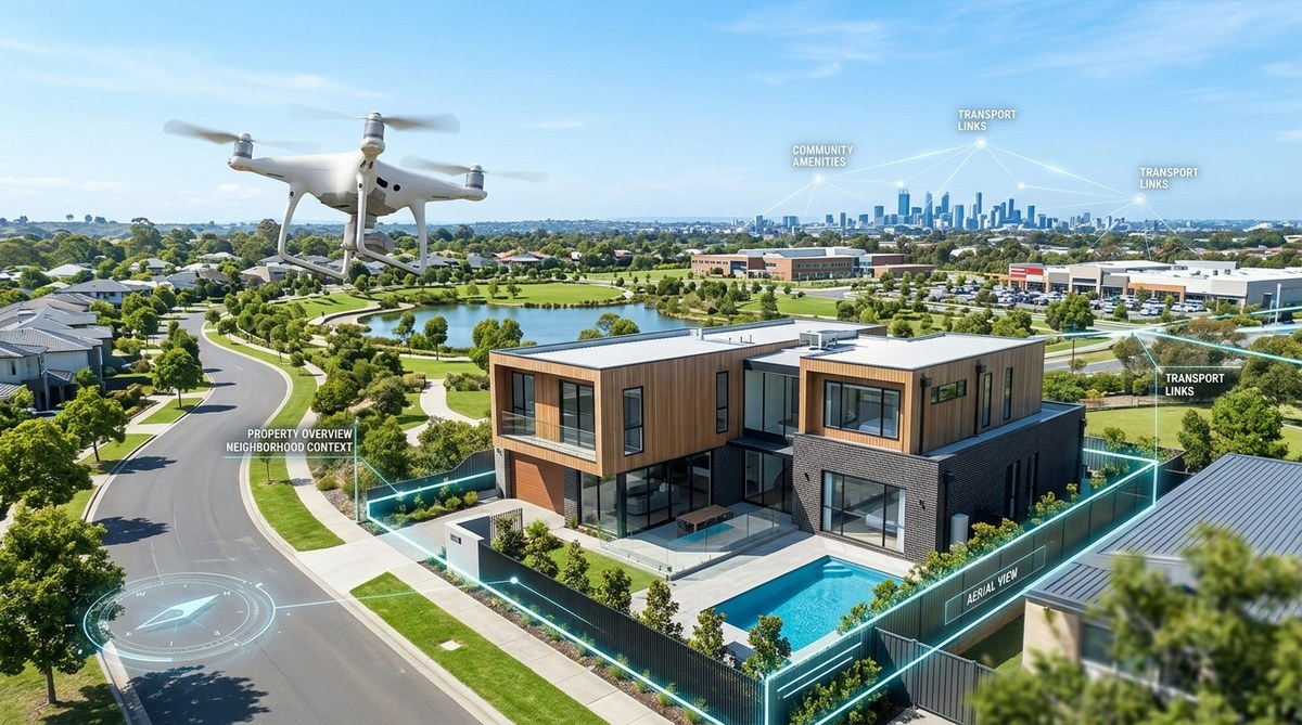
Picture a listing that sits on the market for weeks. The photos look fine from the front door, but buyers just aren’t biting. Now imagine the same property shown from above. The buyer sees the full acreage, the pool layout, the roof condition, and the neighborhood green space in one sweeping shot. That shift in perspective changes everything. Drone photography has moved from a “nice to have” to a near necessity for serious agents in 2026. Buyers expect to see the whole story, and ground level images only tell part of it.
Drone photography real estate benefits go beyond pretty pictures. Aerial views help buyers understand property size, lot features, and surrounding context in seconds. Listings with drone photos sell up to 68% faster than those with standard images alone. In 2026, buyers filter homes by visual quality first. If your listing lacks aerial perspective, you risk losing serious offers before the first showing.
How Drone Photography Changes Buyer Behavior
Buyers scroll through listings on their phones during lunch breaks. They make snap judgments in under ten seconds. A standard front facing photo competes with hundreds of others. An aerial shot stops the thumb.
When you show a property from above, you answer questions before they are asked. How big is the backyard? Is there a patio? Does the house sit on a corner lot? How close are the neighbors? These details matter more than ever in 2026, as buyers prioritize outdoor space and privacy.
Drone footage also builds emotional connection. Seeing a home nestled among trees or overlooking a lake creates desire. That feeling pushes buyers to schedule a tour instead of scrolling past.
The Core Drone Photography Real Estate Benefits
Let’s break down exactly what aerial imaging does for your listings.
- Faster sales. Properties marketed with drone photos spend less time on the market. The aerial context helps buyers self qualify before they visit.
- Higher perceived value. A listing that includes drone footage looks more professional and premium. Buyers associate quality marketing with a well maintained property.
- Better online engagement. Social media posts with drone views get more shares and comments. Your listing reaches a wider audience without extra ad spend.
- Accurate property representation. Large lots, acreage, and unique layouts are hard to capture from the ground. Drones show the real scale of the property.
- Competitive edge. Most agents in your market still rely on standard photos. Using drone imagery sets you apart immediately.
For a deeper look at how visual content strategies can transform your approach, check out this guide on maximizing property appeal with stunning visual content strategies.
When Drone Photography Matters Most
Not every listing needs a drone. But many do. Here is a simple breakdown to help you decide.
| Property Type | Drone Value | Best Angle |
|---|---|---|
| Single family home with yard | High | Show lot size, fencing, landscaping |
| Condo or townhouse | Low | Limited benefit unless showing complex amenities |
| Luxury estate | Very high | Highlight acreage, pool, guest house, views |
| Rural or farm property | Essential | Show boundaries, outbuildings, pasture |
| Waterfront | Essential | Capture shoreline, dock, water access |
| Multi unit rental | Medium | Show building layout, parking, common areas |
Use this table as a checklist when planning your next listing shoot. If the property has land, unique features, or surrounding context worth showing, drone photography is worth the investment.
Common Mistakes Agents Make with Drone Photos
Even with the right equipment, bad execution can hurt your listing. Here are the most frequent errors and how to avoid them.
“The best drone shots tell a story. If you just fly straight up and snap a photo, you are wasting the opportunity. Move the camera to highlight the path from the street to the front door. Show how the house sits on the land. That narrative sells homes.” — Sarah L., certified drone pilot and real estate photographer
Mistake #1: Flying too high. A shot from 400 feet shows the neighborhood but not the house. Keep the altitude low enough to see details. Aim for 50 to 100 feet for most residential properties.
Mistake #2: Ignoring lighting conditions. Midday sun creates harsh shadows. The golden hours (early morning and late afternoon) give soft, warm light that makes homes look inviting.
Mistake #3: Skipping video. Still photos are great, but a slow aerial video tour sells emotion. Buyers can imagine themselves driving up the driveway or standing in the backyard.
Mistake #4: Not editing the footage. Raw drone images often look flat. Color correction, cropping, and slight contrast adjustments make a huge difference.
Mistake #5: Overlooking local regulations. In 2026, drone rules vary by state and municipality. Always confirm you are flying legally. Hire a licensed operator if you are not certified.
If you want to stay ahead of the curve, take a look at the top visual marketing trends reshaping real estate in 2026.
How to Add Drone Photography to Your Workflow
Adding aerial imaging does not have to be complicated. Follow these steps to integrate it smoothly.
- Evaluate the property. Walk the lot first. Identify key features worth showing from above. Note any obstacles like power lines or tall trees.
- Choose your approach. Decide whether to hire a professional drone pilot or do it yourself. If you fly your own drone, make sure you have proper licensing and insurance.
- Plan the shot list. Write down the angles you need. Include an overhead shot, a 45 degree front angle, a backyard view, and a neighborhood context shot.
- Schedule the shoot. Pick a time with soft lighting. Avoid windy days. Check local airspace restrictions.
- Edit and deliver. Adjust colors and crop for composition. Deliver the final images and a short video clip within 24 hours.
For agents who want to build a complete visual toolkit, the article on 7 visual marketing tools every real estate agent needs on their smartphone offers practical advice.
The Cost vs. Value Reality
Some agents worry about the expense. A professional drone shoot typically costs between $150 and $400 per property. Compare that to the cost of a listing sitting an extra 30 days on the market. Mortgage payments, price reductions, and carrying costs add up fast.
In 2026, buyers have more options than ever. They can afford to be picky. Listings that look average get ignored. Listings that look spectacular get showings. The math is simple. Spending a few hundred dollars on drone photography can save you thousands in holding costs and price cuts.
Practical Advice for Hiring a Drone Photographer
If you decide to outsource, ask these questions before booking.
- Are you licensed by the FAA? This is non negotiable.
- Do you carry liability insurance? Your brokerage may require proof.
- Can you show examples of real estate work? Look for variety in property types.
- What is your turnaround time? Same day or next day delivery is ideal.
- Do you provide both photos and video? A combined package gives you more content.
A good drone photographer will also offer editing services. Raw footage is rarely ready for listing sites. Make sure the final product matches your brand standards.
Looking Ahead: Drone Tech in 2026
The technology keeps improving. Newer drones offer better cameras, longer battery life, and automated flight paths. Some models now include obstacle avoidance sensors that make flying safer in tight spaces. Software tools allow you to create 3D models of properties from aerial data. That means buyers can take virtual walkarounds before ever stepping foot on the lot.
But the basics remain the same. Good composition, proper lighting, and thoughtful storytelling matter more than the latest gadget. Focus on the benefits of drone photography for real estate, and the results will follow.
For agents interested in the intersection of technology and property marketing, the guide on embracing the future of property tech with AI-driven virtual tours covers what is next.
Making Drone Photography a Standard Part of Your Listings
Start small. Pick your next three listings that have strong outdoor features. Schedule drone shoots for each one. Track the results. Compare time on market, number of showings, and offer prices against similar properties that used only ground photos. The data will speak for itself.
Buyers in 2026 are visual, impatient, and informed. They want to see the full picture before they pick up the phone. Give them that view. Aerial photography is not just a marketing tactic. It is a way to respect your client’s time and present their home in the best possible light. Add it to your workflow, and watch how your listings start performing differently.